12 Lancaster buildings - including a former leper hospital - get new plaques marking their place in history
and live on Freeview channel 276
The Mill Race area of the city is the main focus of the Lancaster High Streets Heritage Action Zone, led by Lancaster City Council with support from partners including Lancaster BID and Lancaster University.
And as the Guardian went to press, 12 new plaques were being installed on historic buildings in the area as part of a new Mill Race Heritage Trail due to be launched before the end of the year.
Advertisement
Hide AdAdvertisement
Hide AdThe trail, created by Lancaster City Council and Lancaster Civic Vision, will give a flavour of the buildings, industries and people who shaped an area which still bears traces of every period since its development from Roman street layouts and medieval street names to Victorian industries and Edwardian businesses.

The Mill Race is a channel of water that lies underneath some of Lancaster’s low lying streets, including North Road, and is thought to have gained its name in medieval times for powering mills including the town’s circa 1574 corn mill.
Although it was culverted from the late 1800s because of health concerns, the Mill Race, which is part of Lancaster Conservation Area, does rear its head occasionally, as seen during the 2015 floods.
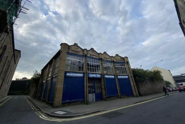
Among the buildings highlighted with plaques on the trail are two pubs: The Stonewell Tap in Lower Church Street which first became a pub in 1806 and is the earliest surviving building in the area; and Greens which began life as one of the country’s first purpose-built car showrooms, designed by acclaimed Lancaster architects, Paley and Austin.

Advertisement
Hide AdAdvertisement
Hide AdThe fascinating history behind the Dyehouse, now Cunningham Jewellers, and Robert Dalton’s corn mill, both in Damside Street; and the Drill Hall in Phoenix Street from which soldiers were deployed to the World War One battlefields, is also uncovered by the trail and marked by plaques.
Perhaps more familiar buildings which feature on the trail and are having new plaques are St John’s Church, the Gillow showroom in North Road, and Abbott & Co Glassworks in Chapel Street.
St John’s, built in 1755, is a Georgian gem which saw a tower added in 1784 by renowned architect, Thomas Harrison, who designed Skerton Bridge. It was also the setting for the launch of consultation on a Conservation Management Plan for the Mill Race area which ends on December 16.
Now student accommodation, for decades Gillows fine furniture was displayed in an opulent showroom in North Road designed by Paley and Austin and opened in 1882, and for more than 100 years, William Abbott’s studio and shop in nearby Chapel Street, specialised in decorative stained glass.
Advertisement
Hide AdAdvertisement
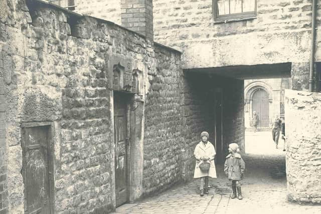
Hide AdThe other four buildings receiving plaques are the Phoenix Rooms in Phoenix Street, built for Lancaster Coffee Tavern Company, and premises in St Leonard’s Gate identifying the site of Richmond’s carriage showroom and an example of one of the city’s once densely packed lanes of worker housing. The reason why St Leonard’s Gate is so called is explained in a plaque at 139 St Leonard’s Gate – the former Roman road was the site of St Leonard’s Leper Hospital founded in the 1100s.